Map4Accessibility is developing a pan-European accessibility mapping app to provide information on the accessibility of public spaces across 4 European cities. The App is an accessibility map which outlines the physical and web accessibility of various objects and provides precise information on accessibility of places at the city level. It covers accessibility standards, embeds Universal Design Principles and is adapted and co-designed through service-learning activities with higher education students.
The first Result of this project focuses on providing an overview and a benchmark of accessibility mapping projects and publications to collect feedback for the development of the Map4acessibility Progressive Web App (Project Result 3). Furthermore, the document outlines the service learning and community mapping methodology applied in the project. It is based on an innovative service-learning pedagogical approach which provides an overview and application of community mapping practices with a focus on exploratory and urban walks as community mapping methods, outlines the gaps in current accessibility mapping tools, needs and requirements in both physical and digital accessibility and provides a facilitation guide on how to apply the methodology. The document is addressed to the scientific community and the partnership, bringing elements for the improvement of the overall accessibility of urban areas.
Three are the interlinked leading concepts that discern the Map4accessibility project in its Methodology, PR1.
Service-learning is introduced in the form of tracing down accessibility of public places via the Map4accessibility app. Service-learning is defined within the project as an educational approach involving projects and programmes of community service aiming to satisfy an actual need within a certain territory in collaboration with, but not only, the community. Students’ participation is central – from the initial planning phase to the final evaluation – and intentionally linked with their learning experience, including curricula, reflections, skills development.
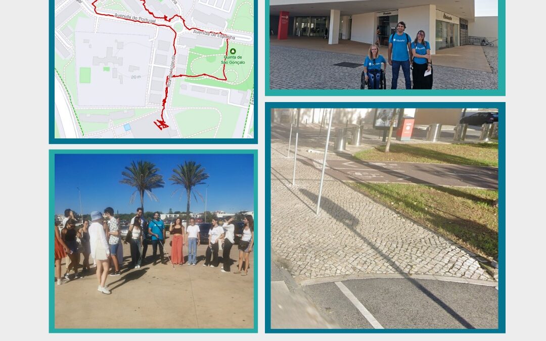
PR1 MAP4ACCESSIBILITY SERVICE-LEARNING AND COMMUNITY MAPPING METHODOLOGY outlines the service-learning and community mapping methodology to be applied in the project. Exploratory and urban walks are the practical and actual activities that involve students within the project where the service-learning concept is employed to map the accessibility and/or barriers in the cities. While the exploratory walks aim to outline the characteristics of the Map4accessiblity app, the urban walks further test it and perform the actual act of evaluating accessibility of places. The outcomes of the walks are therefore a fundamental testing field for the active involvement of all stakeholders addressing disability and inclusion, the pedagogical innovation in HEIs and urban planning.
To discover more:
Map4Accessibility Service-Learning and Community mapping methodology